High in the Brecon Beacons where the Taf Fachen Valley narrows, sits Pontsticill Reservoir. Popular with anglers and picnicers, it's a lovely spot for a day-visit, there's even a vintage steam locomotive running up the eastern shore.

Overview: Pontsticill & Trevethic Trail
Date: March 22, 2021
Distance: 80.5 miles / 129.55 kilometres
Elevation: + 5022 / - 5023 ft
Duration: 11 hours, 24 mins.
Distance: 80.5 miles / 129.55 kilometres
Elevation: + 5022 / - 5023 ft
Duration: 11 hours, 24 mins.
This wasn't as much of a planned ride as it was just an excursion. I thought I'd ride up to Pontsticill Reservoir in the Brecon Beacons and decide on where to go from there depending the weather and how I felt.
I came back down from the reservoir passing through the villages of Pontsticill, Vaynor, and Trefachen. I wandered a bit taking photos of some unfamilar views and intriguing places along the way.
As it worked out, the day was gorgeous and I was glad to have made the ride up. I cycled on and off multiple routes of the National Cycle Network, specifically; NCN Route 467, NCN Route 46, NCN Route 477 (Trevethic Trail), NCN Route 8 (Taff Trail), and NCN Route 4 (The Celtic Trail). My ride-attude was very laid back.
Newport Road, Bute Town, & Dowlais Top
I left home and headed up my usual route along NCN Route 467 through Quoits Wood to Hollybush. The official route stops at Hollybush because to continue north, you have to enter the narrow and (sometimes) busy Newport Road which is not suitable at all for children.
After a couple of miles you can pick up the route again at Bedwelty Pits where you can drop down along the Sirhowy River and cycle along a traffic-free path to Tredegar. However, I tend to stay on the road the majority of the way. (There is a short section of shared-use path heading into Tredegar.) But for the most part, the road is empty with only a few houses every so often and the views are lovely.
After a couple of miles you can pick up the route again at Bedwelty Pits where you can drop down along the Sirhowy River and cycle along a traffic-free path to Tredegar. However, I tend to stay on the road the majority of the way. (There is a short section of shared-use path heading into Tredegar.) But for the most part, the road is empty with only a few houses every so often and the views are lovely.

I said to myself that I'd wait until I got to the reservoir before I brought out my camera, but sometimes I just can't help myself. Granted that I am biased, but Sirhowy Valley is the unsung hero of the Southeast Valleys. With no train service and little development, it stands out as unspoilt and natural.


Coming up through Tredegar I climb onto NCN Route 46 at Bute Town which follows along the main road running east/west; Heads of the Valley. Far off in the distance you can see a little dip in the horizon; that's Dowlais Top and yup... that's where we're heading.

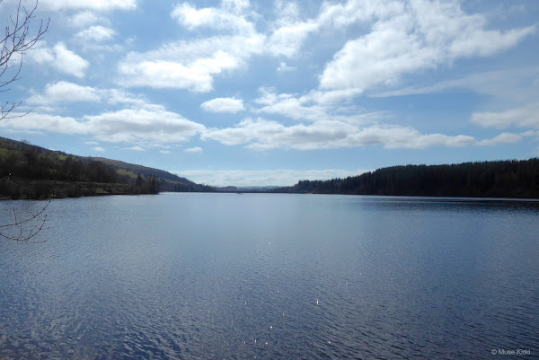
In the photo above you should be able to make out the lake shown in the image below.

There's a surprising amount of infrastructure to help you cycle through Dowlais Top, especially the massive roundabout at the junction of the Heads of the Valley road and the entrance to the shopping complex. The traffic is horrendous, so it's good to be able to get through the mess and onto better venues. (No photos taken... but worthy of documentation.)

Once past all the traffic, the route passes a lovely little pond and like many of the small reservoirs across the Southeast Valleys, sadly this pond hasn't any name. It's days serving the coal mines is long over and the council has re-purposed the site into a lovely pond for fishing and general recreation.
Also of note: this is the highest spot of today's journey... with the exception of a few small short climbs around the reservoir, it's all downhill from here.
Also of note: this is the highest spot of today's journey... with the exception of a few small short climbs around the reservoir, it's all downhill from here.

Looking north in the image below, the Brecon Beacons loom just along the horizon. Meanwhile, geese come honking along at the water's edge — hoping for treats, no doubt.


My next landmark is at Pant, where another architectural ruin is left from Wales' industrial past (below). There are also the remains of a castle just over the hill to our left. You can read about my adventure exploring them in my report; Morlais Castle Explore.


I had planned to take a photo of the junction of NCN Route 46 with the Taff Trail (NCN Route 8). It's a crucial junction, but there was a crowd of mountain bikers and vans parked all about, so I'll have to come back.
Just ahead, I can see that they've been working on the disused rail line that passes over the road. I have my suspicions that it might be developed into part of the Taff Trail. Let's hope!
Just ahead, I can see that they've been working on the disused rail line that passes over the road. I have my suspicions that it might be developed into part of the Taff Trail. Let's hope!


Following the Taff Trail (NCN Route 8) as it continues north to the top of the hill we get our first glimpse of the gorgeous Pontsticill Reservoir.


I snaked my way around the eastern side of the reservoir following an old service road. It's a short side trip of about two miles which offers some mild gravel and interesting remnants along the reservoir.


Brecon Mountain Railway runs a restored steam trains along here during the summer months. Note the narrow width of the tracks. You can often see old "Baldwin" locos pulling open-carriage passenger cars loaded with children and adults up to the top of the hill.


I stop just before the path narrows and heads deeper into the woods. Off to my left (below) are the buildings for the Merthyr Tidfyl Sailing Club.


It's surprising to see the views on my return. The light has changed and going the other way offers a completely different experience.


A perfect little spot for a picnic.


I cycled around to the mighty impressive — 110-foot tall reservoir walkway to take a few snaps before heading back down the mountain to Merthyr.

Looking north over the wall to my left (below). You can see all the way across the reservoir with the twin peaks of Pen-y-Fan (sixth highest mountain in Wales) and Corn Du centered in the far distance.

Turning around 180° and looking over the railing from the walkway to the Art Deco styled pump house (below). I have been unable to find any information on this intriging bit of architecture or how the reservoir actually works. What goes on in that building?


Back over on the other side there's the bell-mouth spillway; an intimidating structure they funnily call "the plug hole". Quite a scary looking feature.


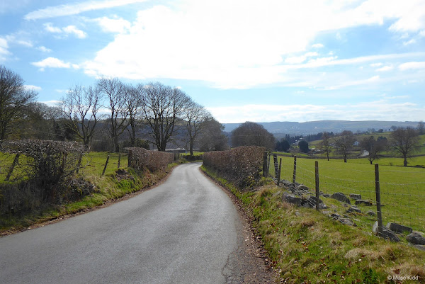
Then on the other side and up through the village of Pontsticill itself. It's a surprisingly steep little climb, but once at the top there is a lovely view back toward the reservoir.

As I was leaving the village, I pulled over to let a man on a huge tractor pass. Farming is everywhere up here and as I stood there, I looked around...
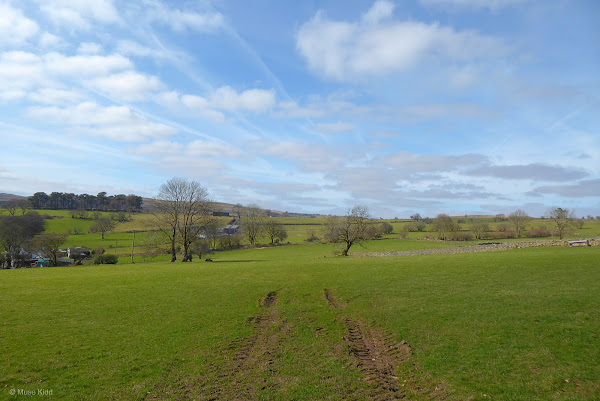
Sometimes I take photos for no other reason than I like the look of a farm, or the ruts in a field converge with the contrails of a jet above, or just a group of trees around the bend of a curve will catch my eye.

Less than 1/2 mile down the road, around the bend as we enter the old village of Vaynor, there is a stately - yet ghostly house, set against the hill side with little fanfare.


I've not seen anything like this in Wales and I love it! As much as I'd like to see it restored, there is something perfect just about the way it is now.

| Sidebar of Note:
To be clear from the start; nothing exact is known about this very unusual house. And in lieu of the actual facts, which often fall away in this mysterious little country, myths just like those of King Arthur are created to fill in the gaps. You can read the legend surrounding this house here: A strange house, a Welsh lawyer and an Italian Contessa.  It is a grade II listed building with Cadw noting it's "finely executed and theatrically designed Italian-style villa of Edwardian date." ☞ Read more: Hy Brasail - A Grade II Listed Building in Vaynor, Merthyr Tydfil |
In my myth-building imagination, there is an old '60's era MGA... or a Jag E-type parked in this dilapidated garage.

Then across the road there is another small architectural remnant... which I also adore equally. Older and wiser, what stories has this little barn seen?

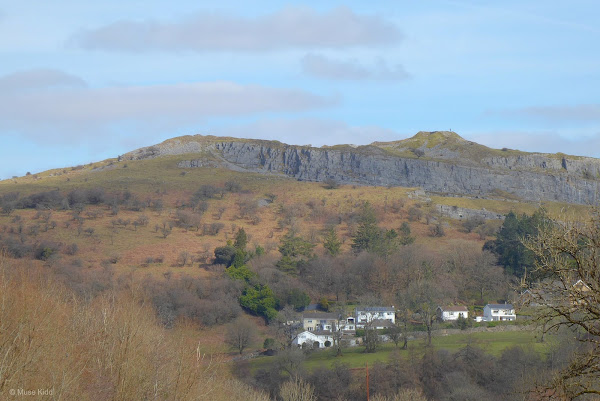
Further down the road we're provided a dramatic view across Taf Fachen Gorge. Far on the opposite side we can see the remains of an old quarry and above it the site of Morlais Castle.

Below the quarry and spanning the gorge, we have Pontsarn Viaduct. Built in 1862 for the Brecon and Merthyr Tydfil Railway, the viaduct spans 465 feet utilizing seven arches at a height of 92 feet.


No longer servicing the railroad, the viaduct provides a spectacular crossing for both walkers and cylists as part of the Taff Trail (NCN Route 8) of the National Cycle Network.

I could easily drop down onto the Taff Trail here, but I'm going to stay on the road just a bit longer to explore. I'll be weaving back and forth, now over and soon under the cycle path (below) as this road parallels the old rail line down to Merthyr.


I pass another abandoned quarry and as I was taking this photo through the trees (above), I realise that this is a nearly perfect portrait of the valleys; "Abandoned". Whilst on the opposite side, I look back toward the hill and Morlais Castle. The valley is beginning to widen and I test the telescopic lense on my camera (below).

I wonder if the men in the photo were aware of each other?

Note: If you're interested in seeing more about this site, be sure to check out my report: Morlais Castle Explore.

Once I got into Merthyr, I rode around the grounds of the old Crawshay estate; Cyfartha Castle. It has a pretty little pond (above) which makes a nice spot for a lunch break, but knowing about the Crawshay family and Cyfartha Ironworks doesn't make me very comfortable with lounging too long.

I made my way through sad old Merthyr Tydfil and got onto NCN Route 477 (Trevethic Trail) down to Pontygwaith. This cycle trail is on the opposite side of the valley from the Taff Trail and follows the legendary Trevethic rail line. Read about Richard Trevthic and his impact on the Industrial Revolution.


NCN Route 477 ends just past this narrow bridge (above) where it joins NCN Route 8 (Taff Trail). The route then follows along this high cliff (below) for about another mile to Quakers yard. From there, the Taff Trail runs all the way down to Cardiff Bay.


I put away my camera here and made my way down to Quakers Yard. The remainder of my ride took me to Pontypridd, across to Caerphilly, then back up through Bassaleg, Crosskeys, and Sirhowy Park.

The last part of my ride was in the dark, but I snapped one last photo before the sun set as I was peddaling along the Monmouth & Brecon canal above Risca.
Summary - Pontsticill & Trevethic Trail
This ride was not so much a route I'd suggest, but a ride where I wandered and explored. I just poked around and looked at things and took picutres.
This ride can be divided into two parts; the first part involved heading up to Pontsticill Reservoir and then coming back down the Trevethic Trail to Merthyr Tydfil. I took most all of the of photos you see in this report during this part of my ride.
On the second half I didn't take any photos. I rode home across the valleys on NCN route 4 (the Celtic Trail) to connect with NCN Route 47 on the Monmouthshire & Brecon Canal (at 14 Locks) with the final push up through Sirhowy Park.
I was out for nearly 12 hours and I climbed quite a bit with over 5,000 feet in elevation gain. It was a wonderful spring day with warm temperatures and it was great to be out cycling under the blue sky.
I hope you enjoyed this little write-up and as always, thanks for spending your time with me & Bike Wales.
Cheers! - muse kidd
| Ride Name: | Pontsticill & Trevethic |
| Start Date: | Mon. Mar. 22, 2021 |
| Starts in: | Oakdale, Wales, GB |
| Departed: | 7:42 am |
| Distance: | 80.5 mi / 129.55 km |
| Elevation: | + 5022 / - 5023 ft |
| Max Grade: | 12.9% |
| Duration: | 11:24:29 |
| Move Time: | 07:42:39 |
| Stop Time: | 03:41:50 |
| Max. Speed: | 29.9 mph |
| Avg. Speed: | 10.4 mph |
| Weather: | sun and more sun! |
| Temp: | 15°c / 59°f |