A short ride from home along NCN Route 467 and the Sirhowy Valley

Once a busy train line carrying passengers up and down the valley, as well as hauling coal from several collieries down to the docks at Newport and beyond; NCN Route 467 is a lovely re-purposed walking & cycling path and a local favourite!
OVERVIEW
Oakdale & Hollybush Ramble
Date: 19 March 2024
Distance: 16.2 mi / 26.07 km
Elevation: +823 ft / -788 ft
Moving Time: 1 hr: 58 mins
Distance: 16.2 mi / 26.07 km
Elevation: +823 ft / -788 ft
Moving Time: 1 hr: 58 mins
I have cycled this route more times than I can count. It's short, easy, and perfect to include at the beginning of a ride as a warm-up or — at the end of a longer ride when I need just a few more miles to reach a milestone.
Also, at just over 15 miles total, its perfect on its own as a quick ride out when I'm hungry to get on my bike. It's an easy distance to keep my legs fresh with some moderate climbing and little worry with traffic.
If you follow this website, you'll notice that this route is at the start of most every ride I make heading north to Tredegar. From our home, it's the shortest and fastest way to get up to the Heads of the Valley.
| ROUTE COLOUR KEY: | Traffic-free | Quiet Road | Shared Use | Steep Hill |
Essentially, this ride runs down the hill from our home in Oakdale, crosses over the Sirhowy River to the town of Blackwood, and then heads up the Sirhowy Valley. The core of the route is the 3.5 mile lower section of NCN Route 467, which runs traffic-free from Blackwood to Hollybush and back.
For a full description of the NCN Route in its entirety; including maps, elevation profiles, downloadable .gpx files, and more, see: NCN Route 467 on this website!
For a full description of the NCN Route in its entirety; including maps, elevation profiles, downloadable .gpx files, and more, see: NCN Route 467 on this website!
Oakdale to Blackwood
Leaving home to begin a cycle ride is an absolute pleasure. I feel very fortunate to live in a small village where my main concerns are pedestrians and dogs, rather than busy roads with speeding cars and thundering trucks.

Ground Zero - Every ride starts and ends here (image above). This is where I turn my Garmin on as I leave and where I turn it off on my return. There was once an old abandoned boy scout hut on this lot, but they tore it down a few years ago with the vague notion of building some houses. So far... nada.
Before I get started, I think it's important to understand a bit about Oakdale. As you can see in the map below, the village has a very unusual layout. Before 1904 there wasn't a village here at all, just a small coal mine operating a short distance north. Then from 1904 to 1923, the entire village was planned and built by the Oakdale Colliery.
Before I get started, I think it's important to understand a bit about Oakdale. As you can see in the map below, the village has a very unusual layout. Before 1904 there wasn't a village here at all, just a small coal mine operating a short distance north. Then from 1904 to 1923, the entire village was planned and built by the Oakdale Colliery.

Sitting on the southwestern side of a prominent hill overlooking the Sirhowy River; the village was designed and built by the Tredegar Iron & Coal Company and the Oakdale Steam Navigation Company to provide a place of "healthful living" for its workers. The idea of a company addressing the lives its workers was at the time a very unusual concept.

Originally, the village was built with 660 homes, then with some recent new builds, the total number of houses is roughly 750. With a population of nearing 5,000 (as of 2021 census), it's not a big place, but it's full of personality.
I first cycle up Ashville Ave. which climbs slightly around to the top of the village. The roads are narrow and traffic is little-to-none. This road along with Markham Cresent and Llwyn-On Road form the outer ring of the "horseshoe".
I first cycle up Ashville Ave. which climbs slightly around to the top of the village. The roads are narrow and traffic is little-to-none. This road along with Markham Cresent and Llwyn-On Road form the outer ring of the "horseshoe".

There are two types of housing in Oakdale; old and new. The old are located within the "horseshoe" which are Edwardian in style and built when the village was first conceived.

The new houses sit along the outskirts of the original village. These ever-increasing "lego houses" suffer from a general lack of character and sadly too, today there are more of these new houses with their ubiquitous front-facing garages circling the village. Urgh.

Despite their blandness, the surrounding housing estates feature a large number of cul-de-sacs — all of which are connected with very convenient footpaths (image above).


Our one and only traffic light seperates Oakdale from the neighbouring village of Croespenmaen — and over 50 additional featureless lego-houses across the road.

I generally turn left and head back around the very outskirts of the village before dropping down the hill to Blackwood.


I turn down Waterloo Road which heads past the Islwyn High School at an exhillerating 16% gradient (image above). Waterloo Road then joins Coal Yard Rise (B4251) which provides a wonderful shared-use walking and cycling path. My route continues down hill, but at a slightly less gradient of only 5% (image below).

Coal Yard Rise is not really a part of the village as it runs along the very outskirts. The road once lead up to the former colliery which stood where the high school now stands.
Also, along this road you can find the sculpture commemorating the Oakdale Colliery. These type of re-purposed winding wheels / sculptures can be found throughout the Valleys wherever coal mines once operated.
Also, along this road you can find the sculpture commemorating the Oakdale Colliery. These type of re-purposed winding wheels / sculptures can be found throughout the Valleys wherever coal mines once operated.


After dropping nearly 200 feet in just a mile, the shared-use path crosses to the other side of the road as I begin to make my way shortly to the Chartist Bridge.

This is the busiest road in the area and it's a huge benefit to have a seperated path.

At the roundabout just before crossing the Chartist Bridge, stands the 26ft. tall Chartist Statue. I wonder how many people pass by this amazing sculpture everyday and not know what he stands for?

Designed and built by the Welsh Artist; Sebastian Boyeson, he's also well-known for his sculpture at Six Bells, The Guardian.

The landmark Chartist Bridge crosses the Sirhowy River and connects the eastern and western sides of the valley. Today they're doing maintenance work on the bridge, however the shared-use path continues (though partially blocked) along the left-hand side.
Once I over the river, I turn right at the roundabout and begin the next leg of my little trip up the Sirhowy Valley.
Once I over the river, I turn right at the roundabout and begin the next leg of my little trip up the Sirhowy Valley.
Blackwood to Hollybush
Just past the roundabout traffic dies down immediately. NCN Route 467 begins rather unceremoniously along the right side, heading quietly into the woods.


Despite being paved, the first section is incredibly bumpy... so much so, I often cycle along the road to avoid it and fortuantely, it's very short. Just across from "The Rock" pub, the traffic-free path begins again in earnest.


Many county burroughs are removing and/or replacing these antiquated A-frame barriers. Not so in Caerphilly. They seem to stick by them regardless of their limited accessability.


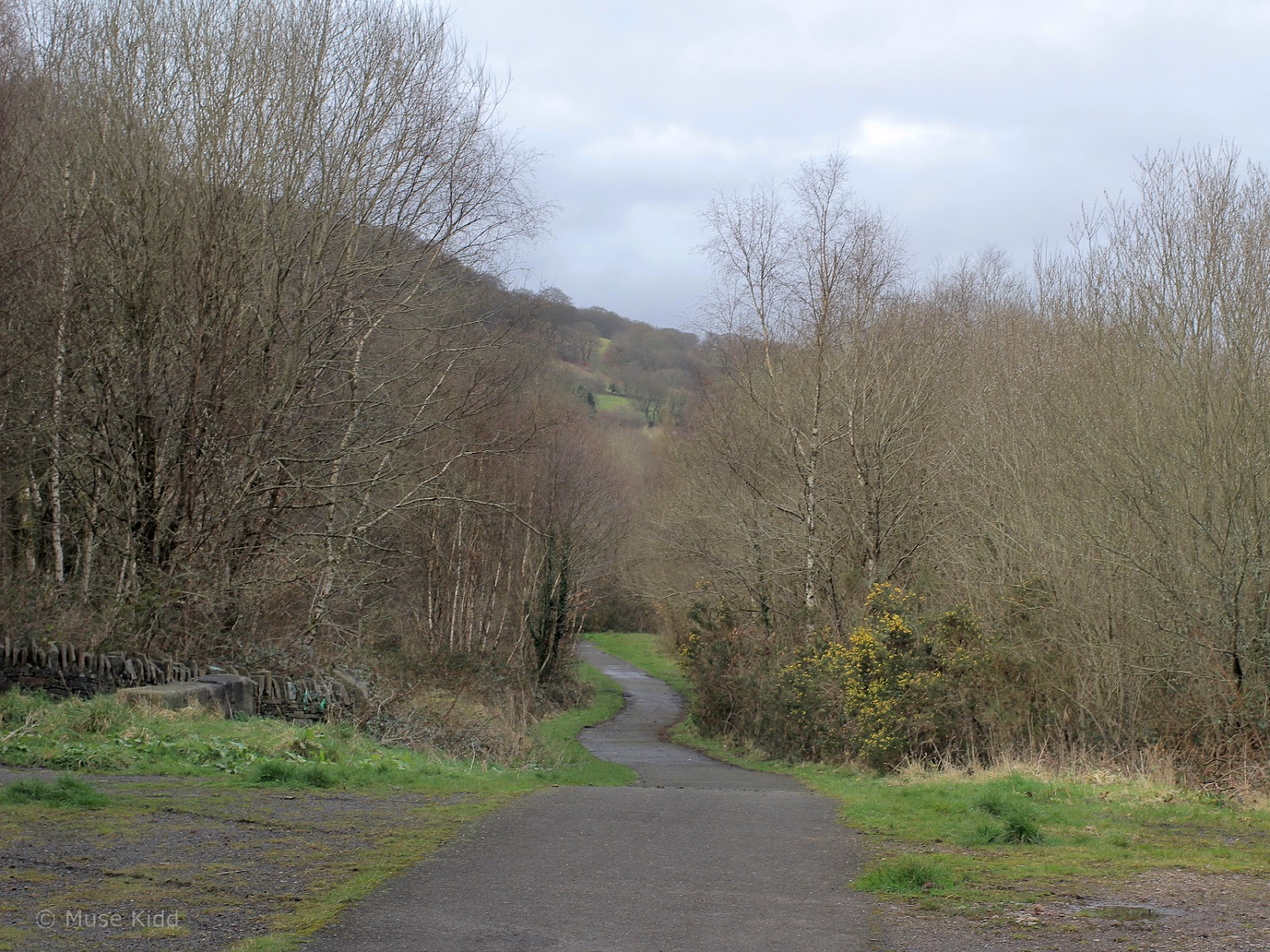
The next .5 mi. runs below the main road. The trees close in and the valley narrows as I approach the village of Argoed.


A portrait bench was installed by Sustrans in 2012 to commemorate the opening of a new walking & cycling bridge, as well as three local legends; Zephaniah Williams - Argoed born chartist leader, Gillian Crandon - former head teacher of Markham Primary School, and Jack Price - International Quoits champion.


Meanwhile the route continues north, passing through a wide area where once two coal mines stood; Llanover Colliery on the eastern side of the valley and Abernant Colliery on the western side (image below).


After passing through the next A-frame I come to an unremarkable spot... unless you look very closely.

Most people don't know about the structure burried on the opposite hillside, but during the winter months, you can still make out Abernant-y-felin Viaduct.

| Sidebar of Note:
Built in 1900 and buried in 1918, it was but a brief existance for the Abernant-y-felin viaduct. Servicing the Markham Colliery, the viaduct began to subside soon after it was completed, so the valley behind it was filled in. The photo below was taken at Manmoel Crossing with the old Tredegar to Newport railway line in the foreground.  Content provided by www.industrialgwent.co.uk and Argoed Community Council |


A mile above Argoed I arrive at the site where Markham Colliery once stood.


I pedal on passing sculptures of unknown meaning or purpose...


... until I reach the top at Hollybush. This is where the lower section of NCN Route 467 ends. (What is the significance of the this sculpture? Who is he supposed to represent?)
Hollybush to Blackwood
I stop and look around. I wonder how long this valley will last before the developers move in? I take a few photos, then turn to head back.


It's easy-peazy gliding back down the valley.


More of the same...


Then I'm down NCN Route 467 and back again at Blackwood by the Chartist Bridge. Time to cross the Sirhowy River again and begin my climb up to Oakdale.


The first mile is seperated from the roadway and perfectly flat, but once on the other side of the road — the long climb begins in earnest.


I shouldn't complain, Coal Yard Rise (or B4251) is not terribly steep at ±5%, but it's a mile long and at the end of the day, it can feel brutal.


Once at the top, from Cherry Tree roundabout (not a Cherry Tree, oddly?) I've another mile back to the house. It's pretty much the same route as when I left home at the start.
SUMMARY
Oakdale & Hollybush Ramble
It's not the most scenic routes, however cycling up Sirhowy Valley has a special charm and because it's so close — we call it home. For a full description of the route up the Sirhowy Valley from Blackwood to Tredegar, be sure to check out: NCN Route 467 on this website!
| ROUTE COLOUR KEY: | Traffic-free | Quiet Road | Shared Use | Steep Hill |
You might have noticed that the images were taken on two different rides, two different bikes, and with two different cameras. March and April can be pretty cold and wet. The temperature varies greatly from ±0°c. to the ±14°c.
Also because this feature covers several rides, it explains why there isn't a Report Card... and to be honest, it's such a short ride, I don't see that it really needs one.
For more images in and around Oakdale, see: My Rides - Alley Cats or My Rides - Ground Zero.
I hope you enjoyed this little write-up and as always, thanks for spending your time with me & Bike Wales. Cheers! - muse kidd