Coming from America, I had not heard of the places Alexander Cordell wrote of in "Rape of the Fair Country". I knew nothing of the landscape or the people and yet, I am deeply drawn to this mysterious place and I found myself wanting to discover more.
UPDATED!


- 2013 -
Overview: Cordell Country Heritage Ride
Date: August 08, 2013
Distance: 52.0 mi / 83.68 km
Elevation: +3,024 ft / -3,173 ft
Moving Time: 5 hours : 48 mins.
Distance: 52.0 mi / 83.68 km
Elevation: +3,024 ft / -3,173 ft
Moving Time: 5 hours : 48 mins.
Most all of this ride follows walking & cycle routes of the National Cycle Network; the majority of which are traffic-free! The complete ride, however, begins and ends at our home in Oakdale, so travel along several busy two-lane "B" roads was necessary to reach the official "start".
This was my second ride through the area and I was working on the specifics to create a route for my "Routes to Ride" section. I find this a wondeful ride and its suitable for intermediate level riders looking for an interesting circuit utilizing the National Cycle Network.
So sit back, relax, and join me as I ride by bicycle up through the heart of South East Wales and explore Cordell Country.
2024 UPDATE: This is an updated version of a previously posted Ride Report. As part of my ongoing redesign of this website, each feature from "Rides to Remember" will be re-formatted to accomodate the new larger page layout. All of the photographs have been re-edited and where needed, the text has been re-edited for context and clarity.
Note: The map for this "ride" was originally created manually (post-ride). However, RwGPS no longer supports "rides" created manually and have subsequently deleted them from their database! Therefore; the map shown above is a re-creation of the the ride made as a at a later date and saved as a "route".
For anyone traveling by train, Llanhilleth is an excellent place to begin. NCN Route 465 is right by the train station which first leads you up the Ebbw Fach Valley to Brynmawr. Here it then joins NCN Route 46 for a short distance along the Heads of the Valleys before joining NCN Route 492 just outside of town.
NCN Route 492 then drops down through Garn Lakes, past Big Pit and Blaenavon, continuing uninterrupted — all the way to Pontypool. In Pontypool, the ride joins NCN Route 466 along the Old Crumlin Road to Swffrydand and back to the start in Llanhilleth.
NCN Route 492 then drops down through Garn Lakes, past Big Pit and Blaenavon, continuing uninterrupted — all the way to Pontypool. In Pontypool, the ride joins NCN Route 466 along the Old Crumlin Road to Swffrydand and back to the start in Llanhilleth.
Llanhilleth & Aberbeeg
After leaving the High Street in Llanhilleth and crossing the over the railroad bidge, the first thing you will notice is the grand Llanhilleth Miners Institue. Inside you'll find a community centre which hosts a wide variety of services, a heritage centre, and children' hub.

The Miner's Institute in Llanhilleth is currently undergoing an extensive refurbishment.

NCN Route 465 follows the Ebbw River leaving Llanhilleth...

... and continues along a quiet lane through Aberbeeg.
Six Bells & the Guardian
At the outskirts of Aberbeeg, the cycle path climbs up a short hill to continue through the woods. NCN Route 465 is smooth and wide as it heads gently toward the village of Six Bells.

An old passenger stop along the newly resurfaced cycle route.

Quiet and lush.
 Let us stop for a moment... this is a good place to reflect over the purpose of this ride. To think about a novel and the relevance of where we're visiting and the history of this land.
A glimspe through the trees.
It is very fitting too that we first encounter this grand monument. Hidden by the trees as you cycle up NCN Route 465 from Aberbeeg. Then as the hillsides widen, and the trees part, this sculpture quietly stands before the valley and the small village of Six Bells.

Proud and strong, overlooking the valley.
It is a sublime tribute to the lives sacrificed for the coal industry and should be on every cyclists bucket-list to visit.

.A powerful gesture for the lives sacrificed for coal.

The village of Six Bells sits cradled in the heart of the Ebbw Fach Valley..
Continuing up NCN Route 465, I soon reach Abertillery where I discovered these lovely murals dedicated to another time and the people who lived here then.


The town park was once very popular... now it's dark and desolate.

The smell of damp and wild garlic is intoxicating.
During the early part of the 20th century, Abertillery was a popular host for many sporting events — especially bicycle races! (image below)

Unused, the track is still visable as it now circles the outskirts of a rugby pitch.

At the northern edge of Abertillery Park, the route changes character dramatically as it enters the woods, deep and dark, following closely alongside the Ebbw Fach river.

A lovely little footbridge, worthy of a stop... and a photo or two.

 Alexander Cordell was a British author who's best-known for his intenational best-selling novel Rape of the Fair Country. Published in 1959, it is the first of a trilogy including The Hosts of Rebecca and Song of the Earth, which portray the stories and struggles of living in South Wales during the early industrial era.
Although some critics scorned his romaniticism, Cordell was dedicated to presenting his stories within historical facts. His work centered around actual events such as Chartism and the Newport Rising, the birth of trade unionism, and the Rececca Riots. Cordell visited much of Wales, especially the South Wales Valleys, researching the precise details of these events as they occurred. The historical depictions Cordell portrayed in his novels resonated deeply with his readers which made his books extremely popular and continue to do so even to this day.
Cordell was born George Alexander Graber in the former British colony of Colombo, Ceylon (now Sri Lanka) on 09 September 1914. He spent much of his formative years in Ireland, London, and most notably China, which became the subject for three of his novels; The Sinews of Love (1965), set in Hong Kong, The Bright Cantonese (1967), a spy story, and The Dream and the Destiny (1975), about the Long March of Mao Tse-tung. Overall, Cordell wrote 28 novels, mostly were historical romances featuring larger-than-life characters set against socially relevent topics.
He served in the British army from 1932 through the Second World War when he achieved the rank of major in the Royal Engineers. Shortly after demobilisation in 1946, he went into the civil service as a surveyor in Shrewsbury (just on the other side of the Welsh border.) From then and there he began writing his first novel, A Thought of Honour. However, it was not published until 1954 and attracted little readership. Undaunted, he was determined to become a successful novelist and applied himself to the task of writing with fierce determination.
Cordell later settled in Llanellen, near Abergavenny in 1950, finding work in Monmouthshire and the South East Valleys. It was around the old iron towns of Blaenavon, Ebbw Vale and Tredegar, that he discovered the difficult lives, grim landscape, and political injustices which were to become the center of his writing. This area, which was once a cradle of the Industrial Revolution, is now a World Heritage Site and today commonly called Cordell Country.
Interest in Welsh history had long been overlooked and Cordell sought to bring recognition of the past and its many wrongdoings through smart characters, often marginailized by corrupt industrialists and oppressed by governments blind to the inequalities of ordinary people. His characters acted out deeply personal dramas, as they struggled to rise above their harsh circumstances and achieve a better life. His novels embodied the pride of the Welsh who fought against the many injustices served upon them during the 19th and 20th centuries... a pride that exists still to this today.
Cordell lived most of his life in Wales, which included Abergavenny, Milford Haven, Chepstow, and at the time of his death, in Stansty near Wrexham. His birth name was George Alexander Graber, which he later changed to his well-known pen name. He was married twice; first to Rosina Wells (1937) and then Donnie (1973).
He died sometime around the 9th of July 1997, having apparently collapsed while walking near Horseshoe Pass in Denbighshire. His body lay for several days before being found by a local farmer — and at the time, the cause of death was thought to have been suicide (brandy and anti-depressant pills were found in his possession). However, it was later revealed to be of a heart attack, perhaps brought about from the exertion. He was 82 years old. His body lies buried at Llanfoist (along with his two wives), in the heart of his beloved industrial South Wales.
Alexander Cordell's novels have been decried as being overly romantic and too deliberately Welsh, which is wholely unfair (in this writer's opinion.) His writing captured something entirely unique to the Welsh spirit and there is no denying the power and majesty which his stories depict. He remains to this day, a writer of great renown.


The irony of Margaret Thatcher closing the mines, putting tens-of-thousands out of work (essentially devastating the Welsh economy)... is that nature is slowly reclaiming these valleys, making them lush and fertile — perfect for walking and cycling.

Nantyglo, Round Towers, & Brynmawr
Coming out of the woods, NCN Route 465 comes alongside the A467 dual-carriageway moving past Blaina and Nantyglo. This is the least scenic part of the ride, but after a little more than a mile the route returns to the quiet lanes and leads up to the Round Towers at Nantyglo.

The last private fortifications built in Britain.

The second tower, further from the road and falling into disrepair.

Leaving Nantyglo, NCN Route 465 ends as it joins NCN Route 46 high along the Heads of the Valley. Turning east toward Brynmawr, NCN Route 46 then passes through Parc Nant-Y-Waun.

After passing though the sleepy village of Brynmawr, we leave NCN Route 46 turning south onto NCN Route 492 and begin a slow climb to the top of the ridge.


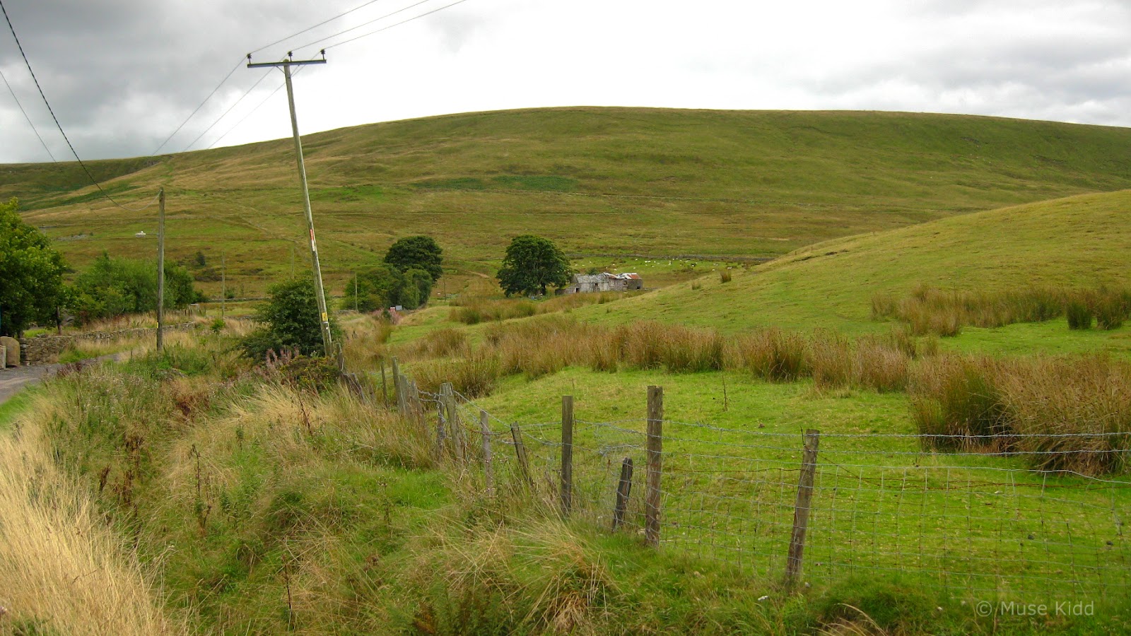
As you continue slowly climbing along the Heads of the Valley, it feels as if you left all of civilization behind.


Garn Lakes
Once over the ridge, we then enter wide moors previously covered in spoil from the colliery workings. This is the highest part of the route and quite a unique Landscape. Completely exposed to the elements, the wind often howls across the grasslands and if you happen to be caught in the rain, it can be brutal!

Riding along the moors above Garn Lakes...

More of the moors...

Looking back...
Wild and wind-blown...
Garn Lakes Nature Reserve covers 40 hectares with lakes and grasslands transformed through an extensive land reclamation scheme. Opened in 1997, it is part of the Blaenavon World Heritage Site and sits just above Big Pit and the town of Blaenavon.


Blaenavon, Big Pit, and the Historic Railway
You can't miss Big Pit and the heritage railway as you cycle down from Garn Lakes for the path follows right beside the rail line. However, if you want to go into Blaenavon proper, you'll need to turn left at the road crossing between the Rhymney Brewery and the entrance to Big Pit.
I'm not going to begin to summerize what many folks have already put together regarding Blaenavon. The Blaenavon World Heritage Site is vast and consists of many interesting places to visit - each can take a few hours to fully explore. If you're planning on making this ride in a single day, I'd recommend checking out their website so that you can choose one to visit. (Of course, this means you'll need to plan another trip to come back!)
I'm not going to begin to summerize what many folks have already put together regarding Blaenavon. The Blaenavon World Heritage Site is vast and consists of many interesting places to visit - each can take a few hours to fully explore. If you're planning on making this ride in a single day, I'd recommend checking out their website so that you can choose one to visit. (Of course, this means you'll need to plan another trip to come back!)

Big Pit is one of Britain's leading mining museums...
The various attractions, events, activities and landscape make a perfect destination for a day out. The main attractions such as Big Pit National Coal Museum, Blaenavon Ironworks, the World Heritage Centre and Blaenavon Heritage Railway are all just a few minutes’ drive or walk from each other. Indeed, there are so many brilliant attractions that you need to spend more than a day here to enjoy everything – so plan a weekend if you can!
In 2000, UNESCO inscribed the Blaenavon Industrial Landscape as a World Heritage Site, for the part the area played as the world’s major producer of iron and coal during the 19th Century. Today you can see remains of all of the necessary elements needed for the iron and coal industry, including a coal mine, furnaces, quarries, railway systems, ironworkers’ cottages, churches, chapels, a school and a workmen’s hall. All set in a landscape that is favoured by walkers, cyclists and mountain bikers. Enjoy your visit – whenever you come!
And, once you've fully explored Blaenavon World Heritage Site why not discover more about Wales, the first industrial nation, by following the South Wales Route of Industrial Heritage, part of a Europe wide route.
Content provided by Blaenavon World Heritage Centre
The last few miles down into Pontypool are easy and relaxed. The path is wide and smooth and downhill all the way. You hardly need to turn the pedals, just sit back and enjoy the views.

Riding alongside the Blaenavon Historic Rail Line...

Heading down the Afon Lwyd Valley along NCN Route 492...

Uninterrupted and downhill for eight miles to Pontypool...

Remnants of the industrial past...

Still Waiting... sculpture on an abandoned platform quietly remembers.
Once in Pontypool the remaining route back to Llanhilleth first snakes through the city park and High Street before moving onto NCN Route 466 which follows along the Old Crumlin Road. Traffic is very light, but there are a couple of climbs (short but sharp). It's a quiet ride providing time to reflect upon all that you've seen on your ride through Cordell Country.
Summary - Cordell Country Heritage Ride
This ride follows four specific routes of the National Cycle Network; NCN Route 465, NCN Route 46, NCN Route 492, and NCN Route 466. Along with the lovely countryside you'll visit, what makes this circular route truly unique is that it is mostly traffic-free. Thanks to the hard work and dedication of the folks at Sustrans, many of the dissused train lines here in the South East Valleys are now wonderful walking and cycling paths. For more infomation about their work and the routes available thoughout the UK visit: Sustrans.co.uk.
You can ride it too!
Since this ride was first posted, I have created an expanded version which provides additional details, photos, and even a downloadable .gpx file. To to see this route, visit my Intermediate Routes section. Or for more routes of all levels, see my overview: Routes to Ride.
Note: The map for this "ride" was originally created manually (post-ride). However, RwGPS no longer supports "rides" created manually and have subsequently deleted them from their database! Therefore; the map shown above is a re-creation of the the ride made as a at a later date and saved as a "route".
About the update: As I indicated at the start, this is an update of a report I made nearly 10 years ago. Many of the details I currently record were not noted at that time. Maps were manually created with notes written (if any) on paper (now lost).
The original text has been gently massaged to better reflect my thoughts, whilst all of the images have been re-edited (cropped, exposure adjusted, and sharpened). Unfortunately too, most all of the original images have been lost.
I hope you've enjoyed my re-telling of this wonderful adventure. Thanks for visiting.
Cheers! - muse kidd
|
|
|||
| Ride Name: | Cordell Country Heritage | ||
| Start Date: | Thu. December 05, 2013 | ||
| Starts in: | Oakdale, Wales, GB | ||
| Departed: | unrecorded | ||
| Distance: | 42.9 mi / 69.04 km | ||
| Elevation: | +2,998 ft / -2,978 ft | ||
| Max Grade: | 11.2% | ||
| Duration: | 7 hrs: 15 mins | ||
| Move Time: | unrecorded | ||
| Stop Time: | unrecorded | ||
| Max. Speed: | unrecorded | ||
| Avg. Speed: | 5.9 mph | ||
| Weather: | sun/clouds | ||
| Temp: | unrecorded | ||