Getting out of the city isn't always easy on a bicycle, but Sustrans and the Canal & River Trust provide a wonderful route that quickly leaves the chaos of cars and traffic and all the nonsense behind.

Overview: Newport to Pontypool
Date: June 22, 2021
Distance: 45.3 miles / 72.90 kilometres
Elevation: + 2667 / - 2669 ft
Duration: 7 hours, 45 mins.
Distance: 45.3 miles / 72.90 kilometres
Elevation: + 2667 / - 2669 ft
Duration: 7 hours, 45 mins.
From the start, I should qualify that I haven't cycled up from Newport to Pontypool on NCN Route 49 but a few times. And the reason is simple; the canal path was very rough in places and it is mostly up hill. I have; however, cycled down the path from Pontypool to Newport more times than I can count, because going down hill negates many of the problem areas.
Historically, this paricular lower section of the Monmouthsire & Brecon Canal (and adjoining path) have been maintained at a somewhat lesser degree than the upper section because, I surmise; it has been closed to boat traffic and many parts of the canal are now burried under roads and housing.
With that being said, I have to admit that due to some major improvements to the path — I found the route brilliant! Several sections which were previously muddy and rutted have been tarmacced whilst other places have had significant resurfacing as well. I was pleasantly surprised at how much these changes improved the cycling experience when heading north.
Over the past few years work has increased along this lower section of the canal itself; several locks have been restored, vegetation removed, and new boat docks are being built. Canal boats can now cruise as far south as 5 Locks in Cwmbran. I will point out many of these improvements as we continue. (Here's a relevant article: Monmouthshire and Brecon Canal re-opened at Five Locks.)
Note: The map above includes my entire day of cycling from Oakdale down to Newport, north along the M&B Canal to Pontymoile Basin and then back home to Oakdale.
PREFACE | Oakdale to Newport | 21.4 miles
Getting to the start: a very common route for me, heading down through Sirhowy Parc to 14 Locks and then following NCN Route 47 down to Newport.
PART ONE | Newport to Pontypool | 7.7 miles
This is the focus of my ride report; documenting NCN Route 49 heading north along the Monmouthshire & Brecon Canal.
DAYS END | Pontypool to Oakdale | 16.2 miles
Returning home: another very common route for me. However, I spent some time in Pontypool taking photos. I then followed NCN Route 466 to Llanhilleth. From there I was on-road for the remainder of my ride.
SUMMARY | A Review and Future Plans
I begin with my thoughts of the day and what I liked or disliked about the ride. I also include my ideas for improvement as well as a Ride Report Card for the day.
PREFACE
| NCN | 47 |  |
Oakdale to Newport |
Distance: 21.4 miles / 31.43 kilometres
Elevation: +915 ft / -1643 ft
Elevation: +915 ft / -1643 ft
As I begin, I realize that I haven't any photos of this route heading south. It's surprising because I seem to photograph everything. But it's also somewhat understandable because I usually cycle this section early in the morning — on my way somewhere else.
In the meanwhile, I've included a few photos from previous rides for general reference. There are four significant sub-sections and/or locations worth noting; Sirhowy Valley Country Park, Waunfawr Park, the Crumlin Branch of the Monmouthshire & Brecon Canal, and 14 Locks.
In the meanwhile, I've included a few photos from previous rides for general reference. There are four significant sub-sections and/or locations worth noting; Sirhowy Valley Country Park, Waunfawr Park, the Crumlin Branch of the Monmouthshire & Brecon Canal, and 14 Locks.

Once I get through Blackwood, it's an easy hop onto NCN Route 47 at Gelligroes where it enters Sirhowy Valley Country Park. The path is wide and smooth and practically all downhill for over four miles. It's a fine example of excellent cycle path design and is often highlighted by Sustrans in their press materials.

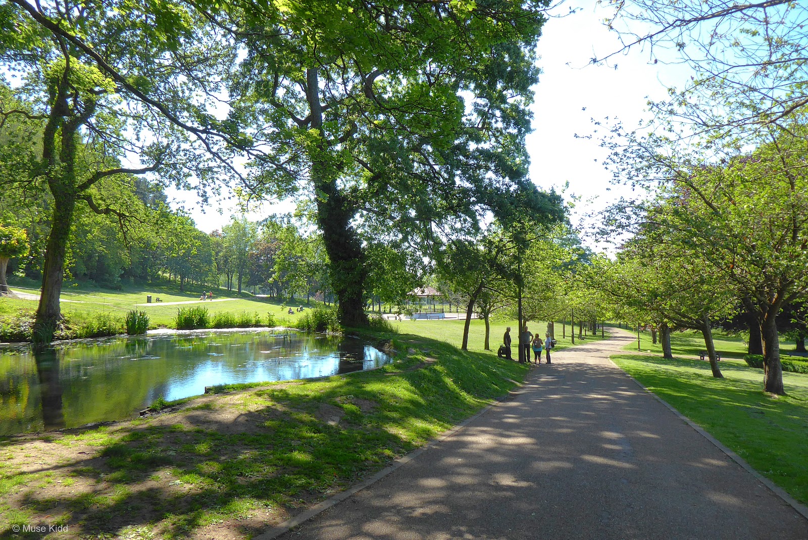
After exiting Sirhowy Valley Country Park, it's just a short ride on the Islwyn Road into Crosskeys where I then enter the lovely Waunfawr Park. The cycle path is well marked and avoids the busy High Street and traffic around the main junction by the train station.
Leaving Waunfawr Park, I continue following NCN Route 47 to re-enter the road briefly, cross over the High Street and navigate up through a small housing estate to then climb up by the canal. Easy-peazy.
Leaving Waunfawr Park, I continue following NCN Route 47 to re-enter the road briefly, cross over the High Street and navigate up through a small housing estate to then climb up by the canal. Easy-peazy.


The canal path is well-paved, wide, and smooth. The ride is a little over three miles to 14 Locks and then another three or so down to Newport. Just simply wonderful cycling.
I should add too, that this branch of the canal is closed to boat traffic. Although much work is going on to maintain the paths and locks, I doubt we'll ever see boats motoring along here. There are just too many sections now covered by roads and housing.
I should add too, that this branch of the canal is closed to boat traffic. Although much work is going on to maintain the paths and locks, I doubt we'll ever see boats motoring along here. There are just too many sections now covered by roads and housing.
Note: This is a perfect example of working on one project and discovering another. Cycling from Oakdale down to 14 Locks and back is perhaps my most common ride and yet I haven't actually documented it. So now I have my first project for 2022; Oakdale to 14 Locks.

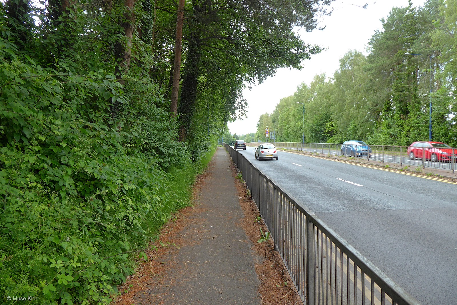
Coming down from 14 Locks is a series of steep hills followed by long flat stretches. After the fourth drop, you will come up alongside the very busy M4 motorway. Thankfully the path is well below the motorway itself, so you are easily protected.
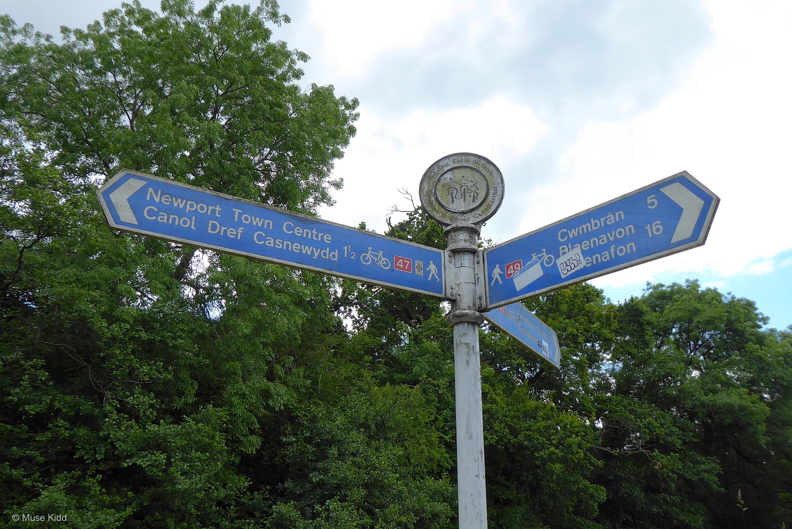
As you continue along side the M4, you will shortly reach a small hump bridge. On the opposite side you will find the junction with NCN Route 49 and the the main branch of the Monmouthshire & Brecon Canal. There is a large white sign post and a wonderful little way marker (shown below).
As you continue along side the M4, you will shortly reach a small hump bridge. On the opposite side you will find the junction with NCN Route 49 and the the main branch of the Monmouthshire & Brecon Canal. There is a large white sign post and a wonderful little way marker (shown below).
PART ONE
| NCN | 49 | |
Newport - Pontypool |
Distance: 7.7 miles / 12.39 kilometres
Elevation: +475 ft / -149 ft
Elevation: +475 ft / -149 ft
In the second part of this report we get to the heart of my cycling project; documenting NCN Route 49 as it follows along the Monmouthshire & Brecon Canal north from Newport to Pontymoile Basin (in Pontypool).
The route is entirely traffic-free; however, there are quite a few road crossings and low bridges to be aware of. I will indicate each significant junction with the pertinant[ Road Name ] for the benefit of clarity.
Despite following a waterway, the route climbs quite a bit, especially through the area of Five Locks. Additionally, there are some sections which are unpaved and/or become narrow. (Check the map and elevation profile closely.)
Access to shops and toilets are plentiful as we will be passing through the heart of many towns and villages. (A small detour off the canal and onto the road is required.)
The route is entirely traffic-free; however, there are quite a few road crossings and low bridges to be aware of. I will indicate each significant junction with the pertinant
Despite following a waterway, the route climbs quite a bit, especially through the area of Five Locks. Additionally, there are some sections which are unpaved and/or become narrow. (Check the map and elevation profile closely.)
Access to shops and toilets are plentiful as we will be passing through the heart of many towns and villages. (A small detour off the canal and onto the road is required.)
Note: It's crucial to point out that NCN Route 492 will parallel this path once we reach Cwmbran. Many folks (including Sustrans) often get the two slightly confused especially when indicating waymarks and points of interest. Be sure to look at the maps closely. Pay particular attention to where and how they cross over each other — they can be a little tricky to navigate from one to the other despite their close proximity.
| ▲ Back to |
| ROUTE COLOUR KEY: | Traffic-free | Quiet Road | Shared Use | Steep Hill |
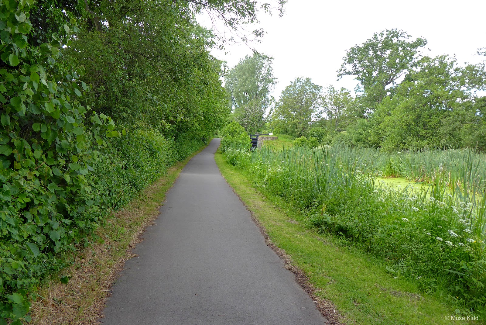
NCN Route 49 begins as you cycle directly underneath the M4 motorway. It's fairly dark and generally wet, so show caution. (photos needed...), but once you come out on the other side, the route opens up nicely.

Note: NCN Route 49 does not in fact, lead to Blaenavon. In order to get to Blaenavon from NCN Route 49, you need to exit the route (in Cwmbran) and join NCN Route 492. This will lead you to Blaenavon. I will elaborate more on this important detail later.

From here the route begins a series of long flat stretches punctuated by short humps which climb along side the canal locks. They are all rather short, but can be rather sharp.
Pay particular attention while crossing the bridge shown below. It is quite narrow and the gate arm extends over the pathway making a tricky little obstacle.
Pay particular attention while crossing the bridge shown below. It is quite narrow and the gate arm extends over the pathway making a tricky little obstacle.


Did you notice the heron in the photo above? Because boats don't come through this lower part of the canal, it's a haven for many aquatic birds, as we shall see!
BETTWS LANE At the first junction, the path leads up to a busy road crossing. It is very well marked with even a traffic signal to assist walkers and cyclists. It should be clear that you cross the road to follow the canal path.
BETTWS LANE At the first junction, the path leads up to a busy road crossing. It is very well marked with even a traffic signal to assist walkers and cyclists. It should be clear that you cross the road to follow the canal path.


Hey Sustrans... are those miles or kilometers?

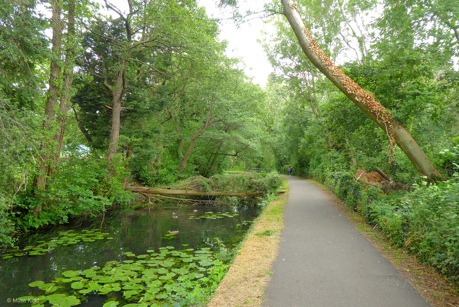
Houses line the opposite side of the canal, but as you make your way north, they slowly fade away as the landscape becomes more rural.

You should be noticing the pattern now; a longish flat section followed by a short hump... flat section and a hump. This pattern repeats itself for the next couple of miles as you pass a series of small bridges, canal locks and road junctions.


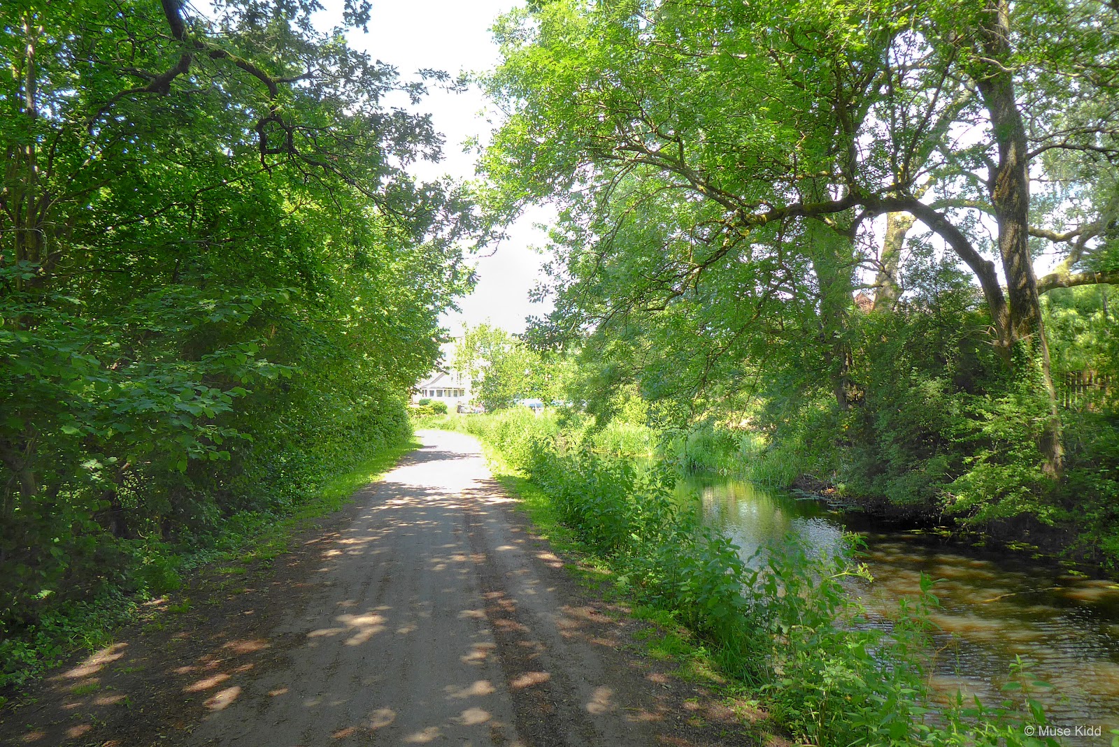
Most of the path is under a thick leafy canopy which is surprisingly cool in the summer and often protects you from any rain.


PENTRE LANE At the next junction we encounter our first Torfaen County Burough route map (shown below on the right). You can find these stainless steel signs along all the cycle paths in the county. [ For tracking purposes; this is location 1c on the Torfaen map. ]
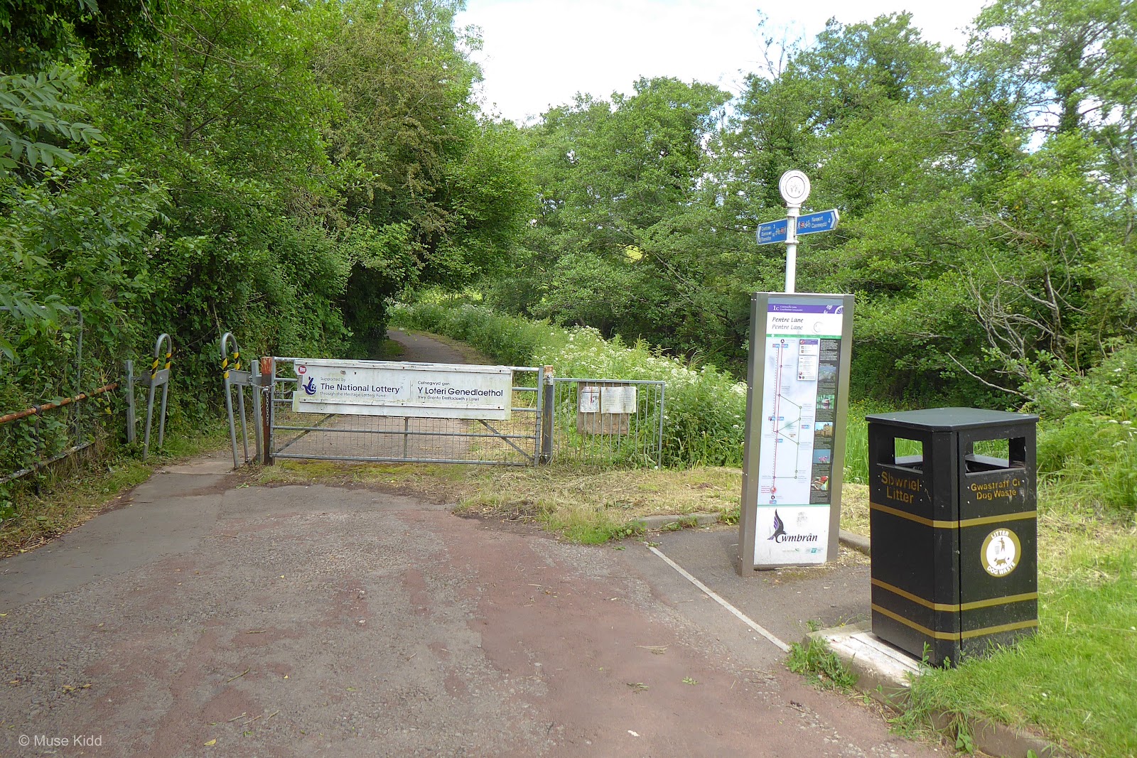
At first glance, these maps look very professional and well-executed. However, I have to warn you; they do not provide accurate information. I will be pointing out some of their serious errors and their important corrections as we continue.
For more on this topic, check out Rasputin Crankshaw's review; "A Small Rant".
But the signs and markers are a seperate topic. We're here to enjoy our day. Continue cycling by simply following the canal and the perfectly clear NCN Route 49 signs.
For more on this topic, check out Rasputin Crankshaw's review; "A Small Rant".
But the signs and markers are a seperate topic. We're here to enjoy our day. Continue cycling by simply following the canal and the perfectly clear NCN Route 49 signs.

The leafy canopy adds to the quiet and the solitude. We could be miles and miles away from civilisation. And then just over the next hump I come across a lovely lady building her nest — completely non-plussed with this cyclist.


We soon leave the protection of the trees as the path climbs up through the newly restored locks at Ty Coch. The hard work they have put in over the past few years really shows. They have done a great job: Read more...


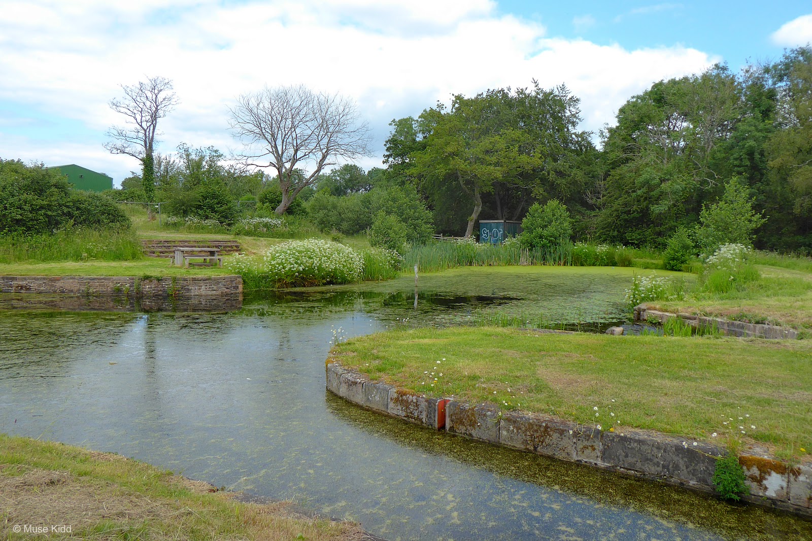
It's wonderful to have such a lovely location so close to the city. We've traveled less than three miles to find this spot for a picnic. It's a great place to bring the kids for a perfectly safe cycling adventure.

Prior to the refurbishment, this section had been particularly difficult to cycle. The path was a mixture of broken pavement and muddy potholes that made the relatively modest climb challenging. Now it's smooth and clear and cycling is a piece of cake.
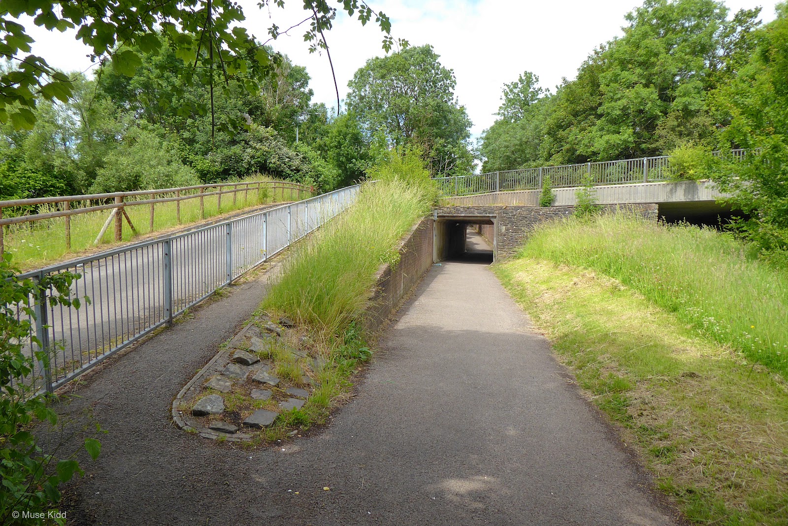
HOLLYBUSH WAY At the next junction, the canal passes under the roadway (shown below on far right) and quite unusually, our path has it's own seperate tunnel also passing under the road. There is access to the upper roadway on either side of the tunnel.
TY-COCH LANE However, at the next junction the path leads up to a small road crossing. It is very quiet, but show caution as you not only cross the road, but the path shifts to the other side of the canal.
On the right side you can see that the canal has been blocked. Unfortunately, this is the beginning where large sections of the canal that are no longer navigatable by boats.
On the right side you can see that the canal has been blocked. Unfortunately, this is the beginning where large sections of the canal that are no longer navigatable by boats.


Once you've crossed the road, the route has a noticably more suburban feel as houses begin to appear along both sides.


TWO LOCKS ROAD As you approach the next junction you are likely to see a gaggle of geese. I haven't any idea why they find this spot so special, but they've been here every time I've come through. Look for them!
The road crossing can be busy and visibility is somehwat blocked by the adjacent buildings, so show caution. Once on the other side, it's short-lived, but quite lovely too.
The road crossing can be busy and visibility is somehwat blocked by the adjacent buildings, so show caution. Once on the other side, it's short-lived, but quite lovely too.
HENYLLS WAY In just .1 mile we reach the town of Cwmbran and our next junction which is much larger and busier. It has a crossing signal to assist walkers and cyclists, as well as a very problematic route map.
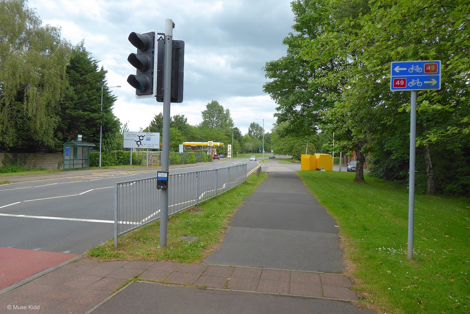
Whomever designed the Torfaen maps presumed they would be installed perpindicular to the path so that the vertical lines shown on the maps would parallel the route itself. That's a reasonable idea; however, when the signs are installed incorrectly (as shown below), it becomes very confusing. This is especially egregious as it appears to lead the user away from route. Thankfully, there are Sustrans signs which correct the issue. [ For tracking purposes; this is location 2c on the Torfaen map. ]
For more on this topic, check out Rasputin Crankshaw's review; "A Small Rant".
For more on this topic, check out Rasputin Crankshaw's review; "A Small Rant".

So now that we've had to (essentially) ignore the Torfaen map, we will follow the Sustrans signs as we begin to make a series of short turns that weave our way through a housing estate (see the map below).
From Henllys Way to Commercial Street, it is almost one continous junction. You'll ride along a short lane before entering onto a shared-use path, then across a bridge, back onto a small lane, and then back onto a traffic-free path (all within .25 mile). As soon as you navigate through one, you'll have another. It is very unique AND I have to say that Sustrans has done an excellent job with the signs to get you through.

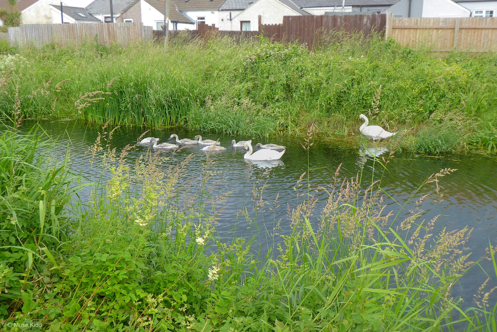
Awww... signets!

Be sure to look to your right before merging.

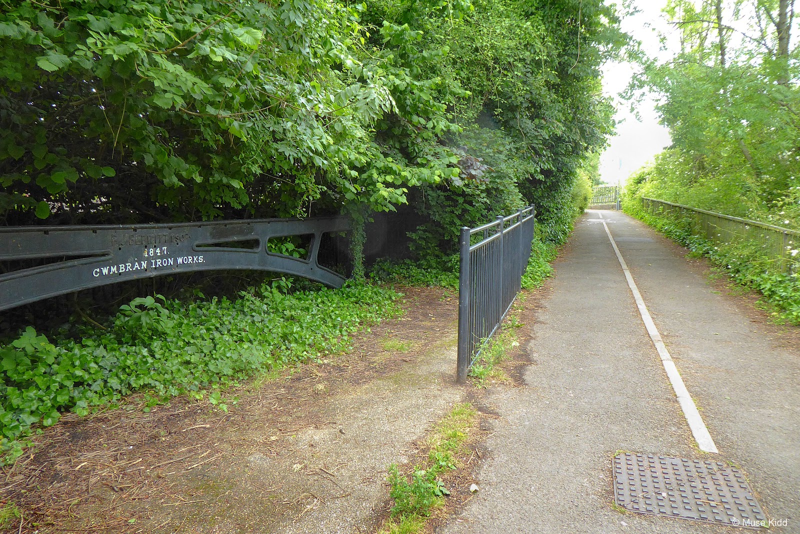
COMMERCIAL STREET After all the weaving, merging, and crossing ends, you'll have one short section passing the former location of Cwmbran Iron Works and then you'll meet the junction of Commercial Street. Here you will find easy access to shops, cafes, and a pub (all on the left in the photo below).

Follow the NCN Route 49 signs across Commercial Street and continue into the woods. It's a drastic change and quite lovely, but it's short-lived as you're about to encounter the most dangerous road crossing of the entire route.

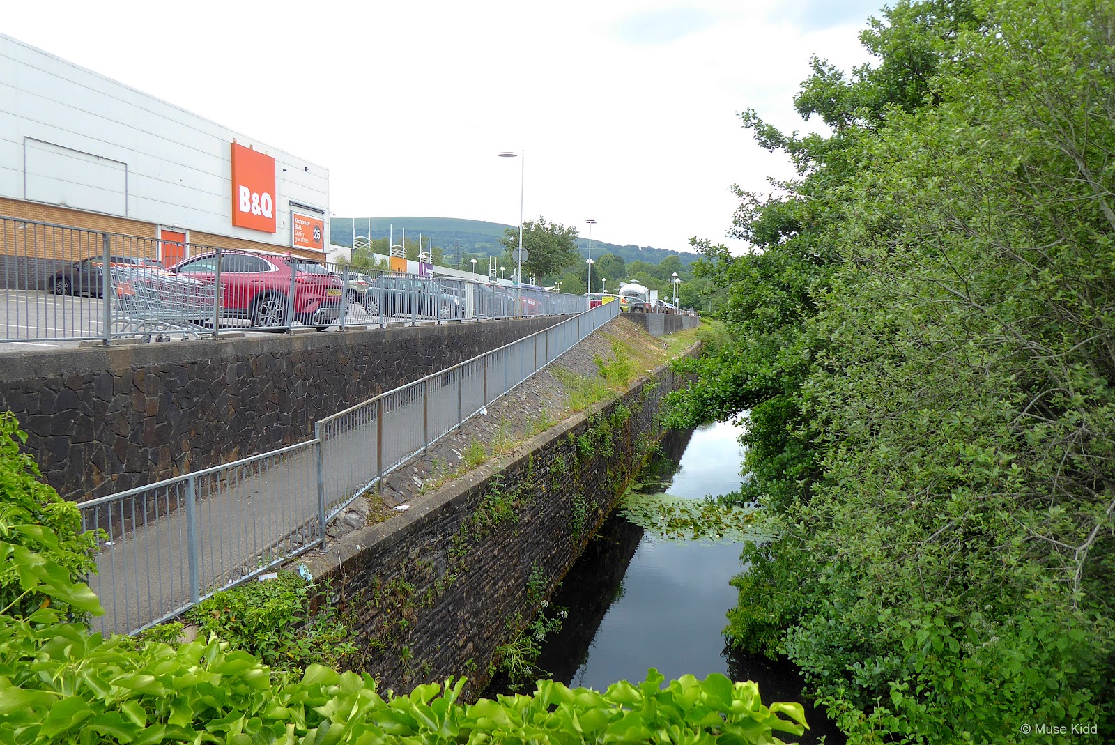
GREENFORGE WAY I don't know what Sustrans or Torfaen County Burough were thinking, but when you come out of the woods, you are thrust upon the junction of Greenforge Way and the roundabout for the A4051; where you have nothing. There are no route signs, no crossing markers, no lights to assist you... you are just left on your own to make it across the very busy junction. Show extreme caution.

Cars coming off the roundabout are often darting across lanes at a high rate of speed and are not watching for pedestrians or cyclists. It is best to get off your bikes and walk with them. When the first set of lanes are clear, push them to the middle and stop. Wait until the next set of lanes are clear and do it again.

I cannot emphasize enough that this is a very dangerous road crossing. (Look at the photo below.) Just north of the junction is Cwmbran Retail Park and to the northeast is Cwmbran Centre. With over 170 retails shops, Cwmbran Centre is perhaps the largest shopping complex in Southeast Wales. This area is always busy and there are no traffic signals.

Once on the other side, be prepared to continue walking your bikes. The path is very narrow as it follows right alongside the A4051 (shown below) and pedestrians are often walking between the junction (you just crossed) and Cwmbran Retail Park (which lies just ahead).
Soon the pedestrians disperse as they head up into the retail park (on your left), whilst the cycle path widens as it continues straight ahead.
With all the excitement of the road crossing(s), you may have forgotten that this route is supposed to be following a canal. So look to your left as it emerges from underground!
With all the excitement of the road crossing(s), you may have forgotten that this route is supposed to be following a canal. So look to your left as it emerges from underground!
I love seeing this kind of historical relic, especially when it's moving along underneath 21st century retail businesses.
I don't think anything here today will last 160 years, what about you? Read about the foundry and forge that once stood here; Cwmbran Works of Messrs Guest, Keen and Nettlefold Ltd. GKN [c. 1800]-1960. (Insert sidebar?)
I don't think anything here today will last 160 years, what about you? Read about the foundry and forge that once stood here; Cwmbran Works of Messrs Guest, Keen and Nettlefold Ltd. GKN [c. 1800]-1960. (Insert sidebar?)


This section of the path was once a "bone rattler". The pavement was broken and rutted, partially repaired, filled with gravel, and almost impossible to cycle over with anything but a mountain bike. Just look at it now. Thank you Torfaen County Burough, this is fantastic.

Our next junction/landmark is a bit of an odd one. To be honest, I have no idea why Torfaen County Burough chose to put this sign board/map here. It is both inaccurate and misleading, so just ignore it. Even Sustrans has it wrong, for this is not the most direct or more importantly, the safest route to the town centre or train station. [ For tracking purposes; this is location 3c on the Torfaen map. ]

If you continue just .1 of a mile further up the path, you'll find the next road junction and the Sustrans directional signs for NCN Rotue 492. This lovely little section is far prettier and safer than trying to navigate through the housing estate.

GREENHILL ROAD As you can see in the photo below, the next junction at Greenhill Road in Forge Hammer is the trailhead for NCN Route 492 as indicated by Sustrans.

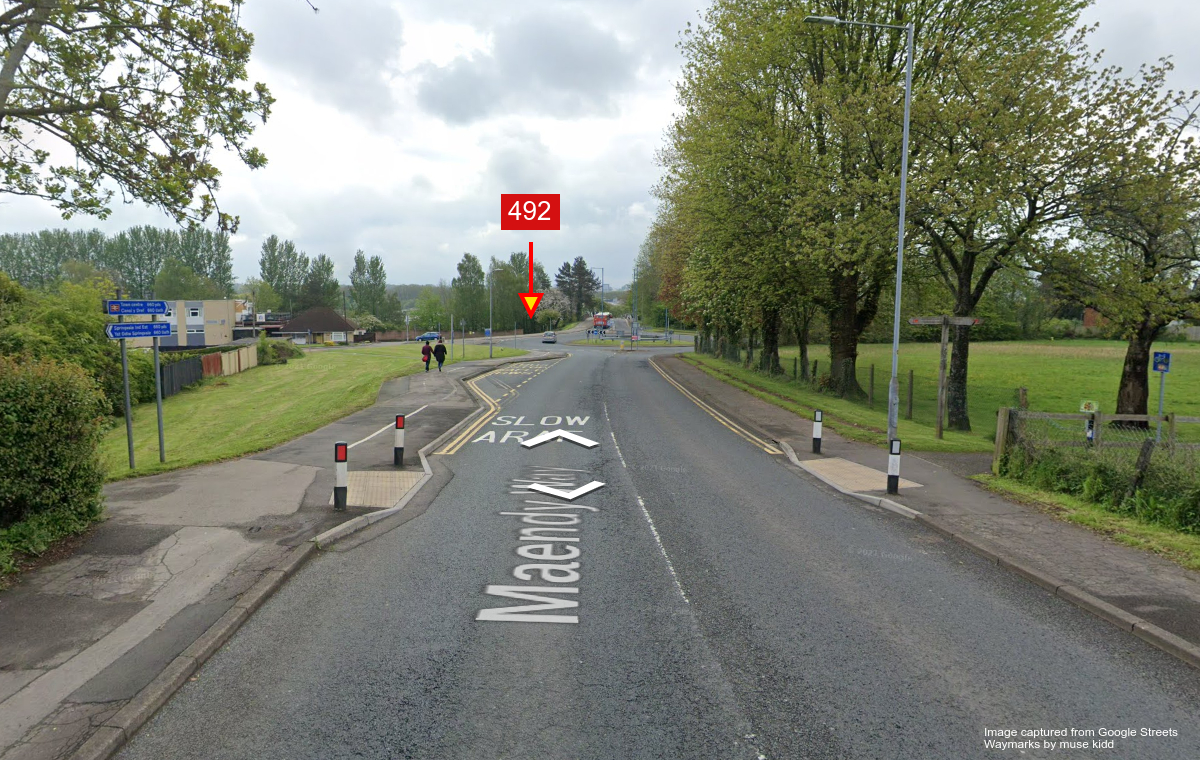
MAENDY WAY However, if you want to take an easier and safer way to join NCN Route 492, I suggest going one junction further to Maendy Way (shown below). From here it is an easy glide down the wide shaired-use pavement with one simple roundabout crossing.
Plus, if you continue straight along the wide shared-use path (shown on the left), it is a direct connection to the town centre and train station.
Plus, if you continue straight along the wide shared-use path (shown on the left), it is a direct connection to the town centre and train station.
COMMERCIAL STREET Oddly, I didn't take any images of the route between Maendy Road and Commercial Street? It is .2 miles, slightly uphill, and the canal is mostly underground. The photo below shows the crossing of Commercial Street itself. (Photos needed.)

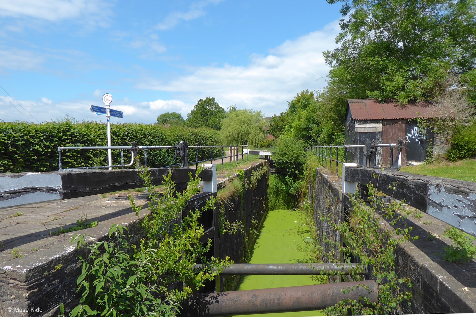
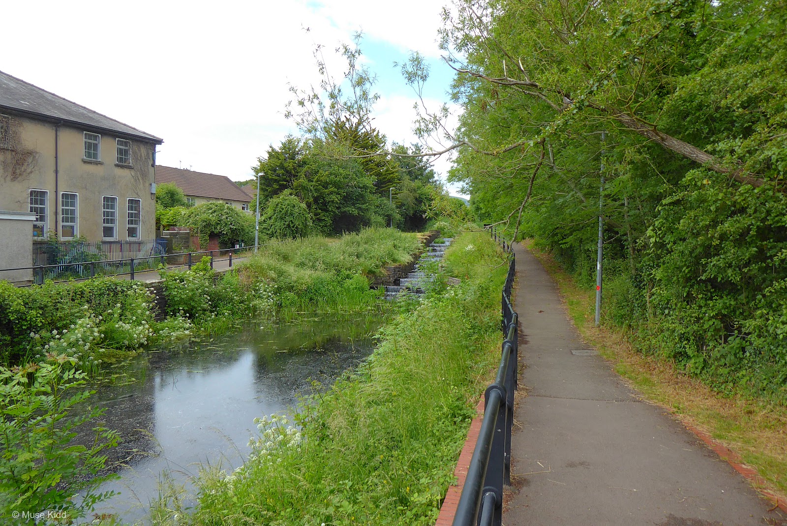
Once you've climbed the short hill, you are amply rewarded. This is the bottom of 5 Locks. From here to the next junction is just .5 miles as you make a series of gradual climbs past each lock.

This section in particular, has been greatly improved over the past few years. Yes, this is a hill, but in actuality, since it has been repaved it is much easier.


And before ya know it, you're at the top. Honestly, the ride up is more rewarding than going down because you get the time to look at the locks and the scenery is just gorgeous.

5 LOCKS ROAD As you come up to the next junction, you'll find that this one can also be a little tricky (shown above). Be prepared to dismount and walk your bikes across the road.
Pay close attention to your right; it is a blind curve for cars coming up the hill. Then, directly ahead is a junction with Greenfield Close. Next, you should note that the path on which to continue is somewhat at a "dog-leg" from where you are standing. Lastly, you'll notice that there are no dropped curbs.
When you compare this crossing to how well some of the previous junctions have been marked, it's almost as if Torfaen County Burough completely forgot about this crossing.

At the top of the small rise, you'll find a wide boat dock. This is 5 Locks Basin and the furthest south boats can currently navigate on the Monmouthsire & Brecon Canal. There are only a few remaining road crossings, they are all well-marked, and the route is just lovely.


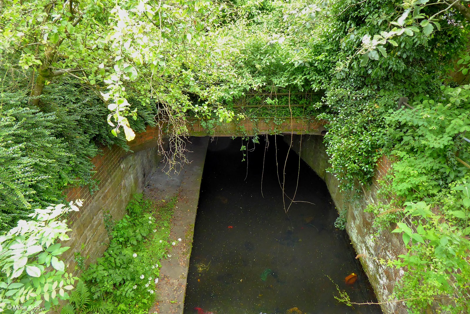
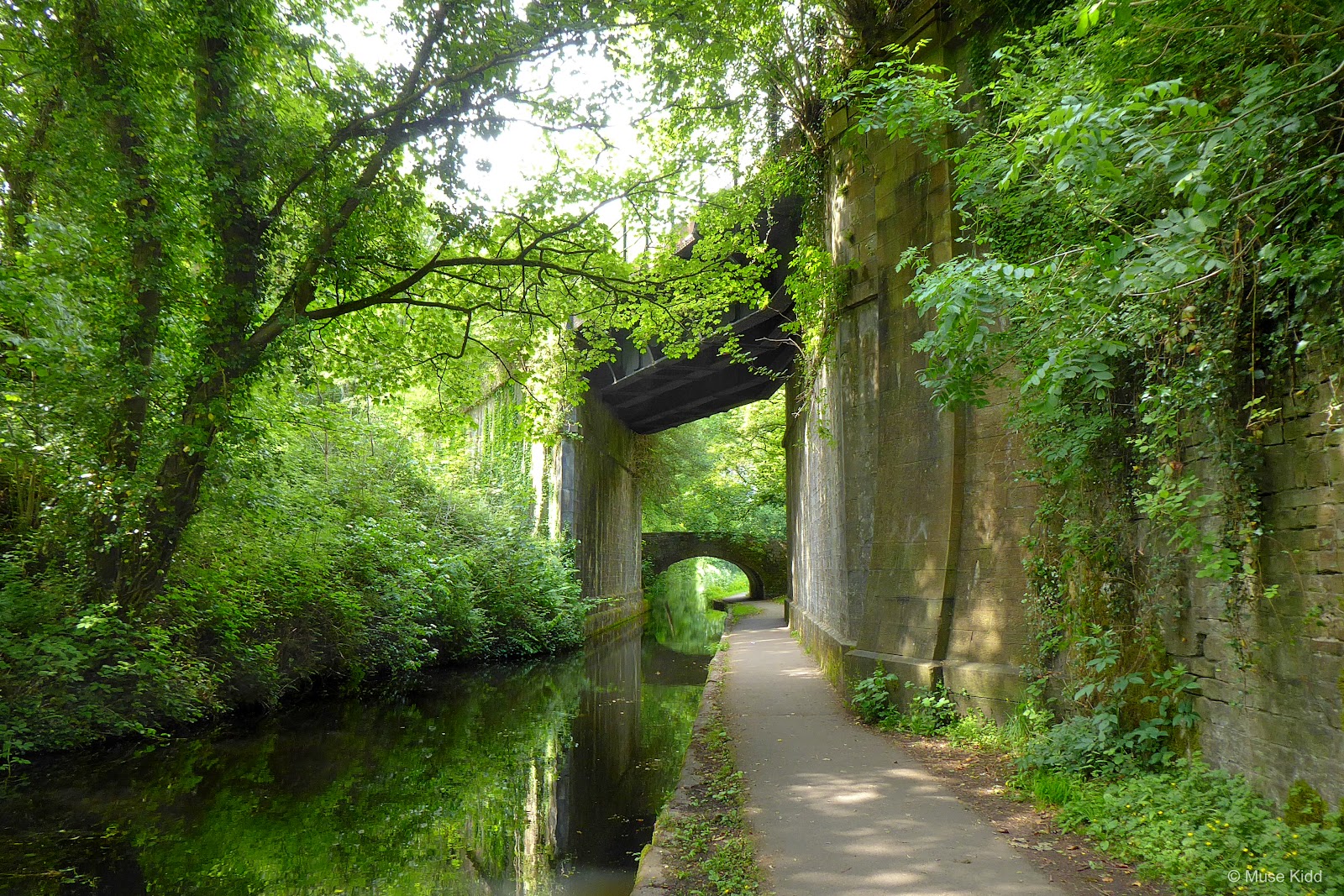
Next we find the Cwmbran Tunnel. Built between 1792-99; it's actually a listed structure! Dark, overgrown, and easy to miss. I cannot imagine riding through it on a small boat. Although it's only 70m long, it's a little spooky looking.


Not too long ago this next section had some of the worst parts of NCN Route 49. Now it is one of the best. This is Sebastopol. There was once a large farm here and part of the path that passed through was just a narrow track that was rough and very muddy. Look at it now!
Along with a newly paved path, they are building new homes along the sides and there is even the beginnings of a boat dock. This is the type of development I can appreciate. Good job Torfaen County Burough.
Along with a newly paved path, they are building new homes along the sides and there is even the beginnings of a boat dock. This is the type of development I can appreciate. Good job Torfaen County Burough.

I've not seen houses built along the canal such as this. It looks great!

Just past the new houses, there's also a new #46 bridge being constructed over the canal for Bevans Lane. When completed it will provide access to additional housing on the far side of the canal as well as the new boat dock. (Photos needed.)
A Look Back
W hilst helping Muse document this part of NCN Route 49, I was doing quite a bit of wandering across the surrounding areas via Google Streets. I've been supplementing many of the junctions and road crossings with screen shots which are often very difficult to capture on a bike, but quite easy online.
I found it surprising that so much of the street views are up-to-date and I wonder how many of those little Google camera vans we have zipping around the country? However, when I got to Sebastopol I was completely shocked to discover how the images of this new development on Bevans Lane are old and out-of-date. It was a goldmine!
So this sidebar is a little taster of images from the past. I hope to supplement this in the future with up-to-date images for a proper before and after report.
My guess is that because this area has been under significant construction for the past couple of years, the little Google van hasn't had a chance to get up here.
We know this area has changed signifcantly, so these are truly pictures from the past. The challenge will now be to try and find these same locations and camera angles in the present.
I need to send Muse back over to Sebastopol to take some current photos so that I can compare those with later versions when Street View is updated. Stay tuned!
I found it surprising that so much of the street views are up-to-date and I wonder how many of those little Google camera vans we have zipping around the country? However, when I got to Sebastopol I was completely shocked to discover how the images of this new development on Bevans Lane are old and out-of-date. It was a goldmine!
So this sidebar is a little taster of images from the past. I hope to supplement this in the future with up-to-date images for a proper before and after report.
 |
| fig.1 - Heading up Bevans Lane from the A4051 roundabout, c. 2017-18. |
 |
| fig.2 - Just before the bridge crossing the canal, c. 2017-18.. |
 |
| fig.3 - On the bridge looking back toward the canal and field, sc. 2017-18.. |

Just past the new bridge is the small bridge (#47) shown above connects to a foot path.

SOUTH STREET Crown Bridge, #48; sits at the junction with South Street and apply named as it sits just below the Crown Pub (upper left).
The junction is well marked and even has a crossing signal for pedestrians and cyclists alike. (This is what is needed at the 5 Locks Road crossing!)
The junction is well marked and even has a crossing signal for pedestrians and cyclists alike. (This is what is needed at the 5 Locks Road crossing!)

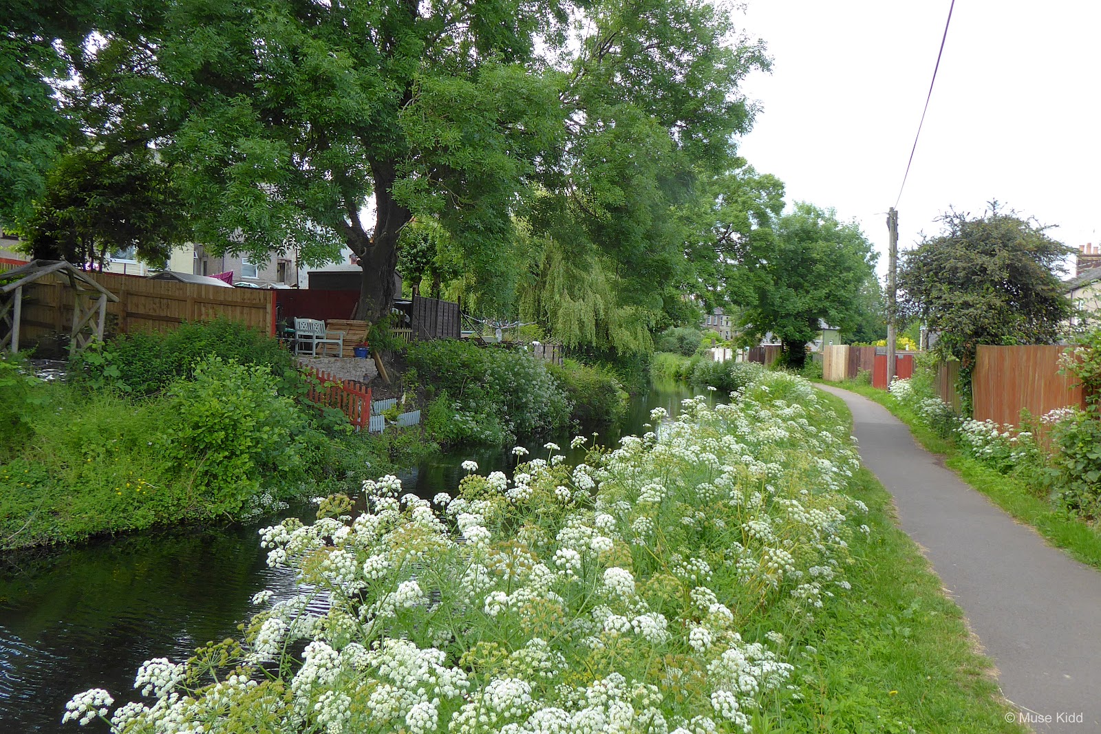
Once on the other side, the path gets quite narrow as it passes the nearby houses. This section too, can often have a fair number of pedestrians and dog walkers, so show special care. Ring your bell.

If you're feeling hungry or just care to grab a pint, the Open Hearth is a fabulous pub with seating right along the canal. Go on, grab a picnic table... I'll get the first round!

KEMYS STREET .2 mile above The Open Hearth you will cross Kemys Street at bridge #49 and just as with South Street, this junction has crossing signals, dropped curbs, and clear signage... just what you want and need from a cycle path.


The path continues through a very lovely section with houses lining both sides, but the path is still quite narrow, so show caution. (Can you smell the wild garlic?)

COED-Y-GRIC ROAD It's just .3 mile to the next junction at bridge #50 which passes under Coed-y-Gric Road. You will need to disembark your bicycles here and walk them under the very low bridge. The path is very narrow as well, so be sure to give a call out or ring your bell before continuing.
The ramp shown on the right in the photo below exits to the road, but there is not an ajoining ramp on the opposite side leading back down to the path.
The ramp shown on the right in the photo below exits to the road, but there is not an ajoining ramp on the opposite side leading back down to the path.

Having passed under the bridge, the path is still very narrow so be prepared to continue walking your bike. You can see too, that their is now a high wall along your right side making it a tight squeeze to pass other cyclists and/or walkers.

The wall ends after approximately 100 ft., and then you have your next significant junction. On your right you'll see a tall sign post for NCN Route 492. That's right! This is the closest the two paths come to each other and as you proceed, you'll soon see that NCN Route 492 passes directly over NCN Route 49 in the most interesting way.


Yup, that's NCN Route 492 passing overhead. Not only does that route follow the old rail line, but it also goes up a different valley. From NCN Route 492 you can get to Blaenavon.

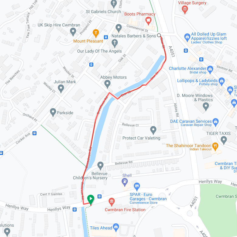
The map below shows just where we are and how the two routes cross then diverge. Also, we've only a short ride to reach Pontymoile Basin from here.


Coming into Pontymoile Basin is quite charming. It's a popular starting point for many walking groups and it's not far from the town centre or the train station.


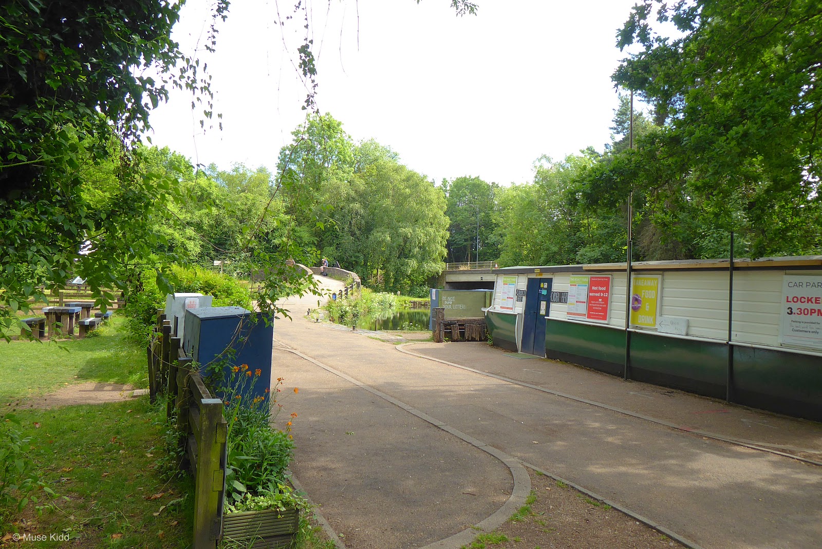
There is a small cafe, restrooms (limited hours), a car park, as well as picnic tables, bike stands, and even some unusual rain shelters/benches for hikers.

For me, this is the end of Part One of my ride report and the main focus of my ride. I'll be editing and reworking the photos for my Raglan Ramble feature over the next few weeks. More about that in my Summary.
DAYS END
| NCN | 466 | |
Pontypool - Oakdale |
Distance: 16.2 miles / 27.07 kilometres
Elevation: +1301 ft / -914 ft
Elevation: +1301 ft / -914 ft
Getting home: the last part of my day is another route I've cycled more times than I can count. It's pretty straight-forward from Pontypool to Crumlin on NCN Route 466, but it gets complicated as I head down to Newbridge, then weave my way up through Springfield, Blackwood, across the Chartist Bridge, and finally home.
I spent some time photographing parts of Pontypool, (again for another project) which I've included here — just to help me keep track of when and what I shoot.
I spent some time photographing parts of Pontypool, (again for another project) which I've included here — just to help me keep track of when and what I shoot.
| ▲ Back to |

Heading out from the basin there are a couple of points of interest. First we enter a quiet lane and as we make our way toward Pontypool Park we have pass a marker/memorial of which I can decern little detail. It seems to have been a watering stop for hourses, but I'm unsure? The carved letters on the face have worn away, but I still like it.

Coming into Pontypool Park we have the lovely cast iron "Sally Gates". Read more...

The park itself is quite lovely too. The paths are exceptionally wide and smooth. There are toilets and a cafe within the leisure centre (limited hours). I find it a wonderful place to make a pit stop before my last push home.


I took a couple of decent shots heading up the High Street, but the town has much more interesting architecture which deserves more attention.


After leaving town I put my camera away and tucked in for the ride home.
Summary: A Look Back and Future Plans
Newport to Pontypool - Over the summer I began working on a long circular route which explores the Vale of Usk, yet begins and ends in Newport. In the back of my mind, I've had NCN Route 49 from Newport to Pontypool as the first section because I feel it is interesting, very straight-forward to follow, and an excellent beginning to warm-up on.
For that reason, I've held off actually documenting this route until I had completed the longer, more complicated route through the Vale of Usk. I finished that earlier in the year and now that I've finally completed this; it's time to stitch them all together.
For that reason, I've held off actually documenting this route until I had completed the longer, more complicated route through the Vale of Usk. I finished that earlier in the year and now that I've finally completed this; it's time to stitch them all together.
Note: The map above includes my entire day of cycling from Oakdale down to Newport, north along the M&B Canal to Pontymoile Basin and then back home to Oakdale.
If you made it this far, you know that I made notes throughout the report, especially regarding additional photos and difficult junctions. Despite this, everything will need to be edited down significantly. The Part One section alone has 85 photos and three supplemental maps. This is far too many for 7.7 miles of cycling! Thankfully or not; the long summer day allowed for my extensive photography.
Even though I'm working backwards to an extent, my overall plan is to create a series of "route modules" which can be stiched together to create interesting and unique rides throughout the Southeast Valleys of Wales. Big ideas. We'll see.
Meanwhile, look for a condensed and re-packaged version of this ride to be added to my Routes to Ride section coming soon.
I hope you enjoyed this little write-up and as always, thanks for spending your time with me & Bike Wales.
Cheers! - muse kidd
| Ride Name: | Newport to Pontypool |
| Start Date: | Tue. Jun. 22, 2021 |
| Starts in: | Oakdale, Wales, GB |
| Departed: | 11:11 am |
| Distance: | 45.3 mi / 72.9 km |
| Elevation: | + 2667 / - 2669 ft |
| Max Grade: | 9.4% |
| Duration: | 07:44:57 |
| Move Time: | 04:30:46 |
| Stop Time: | 03:14:11 |
| Max. Speed: | 31.3 mph |
| Avg. Speed: | 10.0 mph |
| Weather: | clouds, some sun |
| Temp: | 16°c / 61°f |